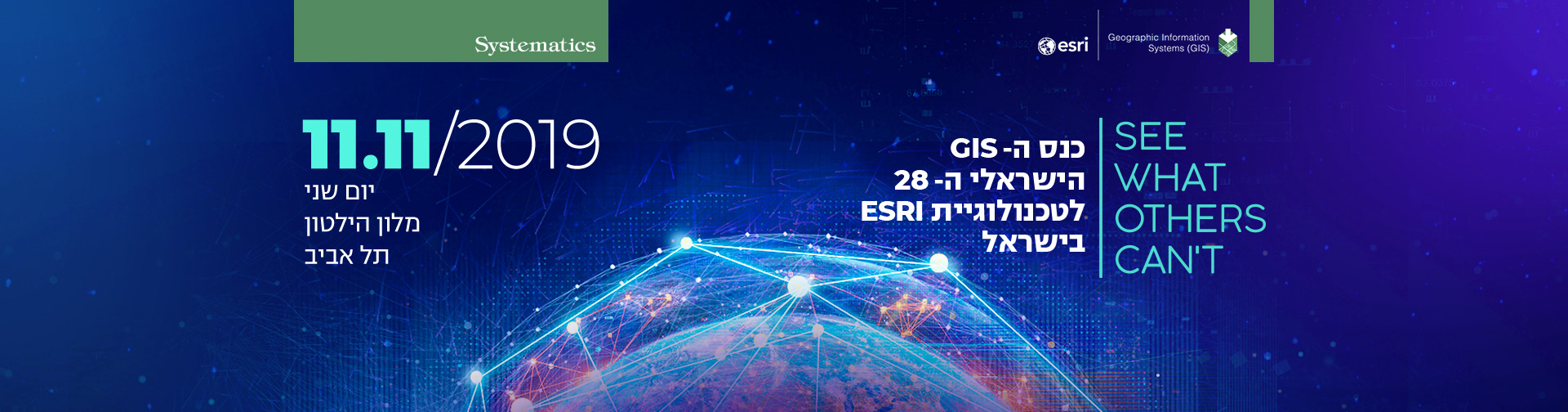
מה מצפה לכם בכנס?
היכנסו לצפייה בקליפ מהכנס בשנה שעברה:
4 מסלולים מקצועיים, שניים מהם יובילו המומחים מ-Esri:
- מסלול 1: Defense & Intelligence – בהובלת מומחי Esri
- מסלול 2: Data Science & A/I – בהובלת מומחי Esri
- מסלול 3: יישומי לקוחות – בהובלת נציגי הלקוחות
- מסלול 4: ArcGIS Pro – בהובלת מומחי סיסטמטיקס
[ סדר יום ]
מנחת הכנס:
נורית גוטהרץ
מנהלת מכירות תחום GIS
סיסטמטיקס
| 8:30-9:00 | התכנסות והרשמה |
| 9:00-9:15 | See What Others Can't אופיר בצר, ראש תחום GIS, סיסטמטיקס |
| 9:15-9:30 | GIS as an Intelligent Nervous System John Day -Director International Government Business Development, Esri |
| 9:30-9:45 | The UpToDate ArcGIS Platform Overview Euan Cameron – CTO Developer Technology, Runtime and Applications Group at Esri |
| 9:45-10:05 | Driving Data in Action Udi Remer – Director of Business Development חברת Mobileye |
| 10:05-10:30 | חדשנות באפליקציות Pro 2.4, Tracker, Excalibur, Quick Capture Anthony Giles – European National Government Solution Engineer, Esri מור יפה, יובל רינצלר, סיסטמטיקס |
| 10:30-11:00 | הפסקה וביקור בתערוכות |
| 11:00-11:25 | סביבות וכלים חדשניים למיישמים, Data Scientists ומפתחים New Map Viewer, API’s & SDKs, Story Map, Experience Builder Euan Cameron – CTO Developer Technology, Runtime and Applications Group at Esri יגאל מונטנר, ליאור אורקין, מיכל גרינולד – סיסטמטיקס |
| 11:25-11:50 | יישומי לקוחות וטקס הענקת מגנים ללקוחות מצטיינים נורית גוטהרץ, מנהלת מכירות GIS, סיסטמטיקס |
| 11:50-12:00 | טכנולוגיות דאטה חדשות שימוש בדאטה מגוון, תלת מימד, תצלומים וזמן-אמת מתוצרת Vricon, Ecopia ו-Spire חשיפת שכבת המיבנים התלת מימדית החדשה של ישראל יוסי לרנר, סיסטמטיקס |
| 12:00-12:20 | פתרונות חדשים – New Geo-Enabled Systems Urban,Hub,Indoors יובל רינצלר, נועם דודזון, מיכל גרינולד – סיסטמטיקס |
| 12:20-13:00 | הפסקה וביקור בתערוכות |
| 13:00-15:00 | 4 מסלולים לבחירה: |
| 15:00-16:00 | ארוחת צהריים |
[ חידושים טכנולוגיים ]
חמישה אורחים בכירים מ-Esri יגיעו השנה לכנס שלנו ויובילו את הצגת כל החידושים:
John Day, Director International Government Business Development, Esri
Euan Cameron, Chief Technology Officer, Runtime and Applications Group at Esri
Rohit Singh, Managing Director Esri R&D Center — New Delhi
Nick Sutherland, European Defence and Intelligence Business Develop Executive, Esri
Anthony Giles, European National Government Solution Engineer, Esri
חידושים טכנולוגיים מחברת Esri:
במהלך השנה האחרונה חברת Esri שחררה 49 מוצרים חדשים! זו כמובן פריצת דרך משמעותית שרק מחזקת את מעמדה של Esri כמובילת ה-GIS העולמית ואת ArcGIS כפלטפורמה עשירה, חדשנית ודינמית.
בכנס השנה הדגש יהיה על חדשנות טכנולוגית וננסה לחשוף אתכם למגוון מוצרים חדשים ששוחררו השנה וגם למספר מוצרים משמעותיים שנמצאים בפיתוח וצפויים להשתחרר בקרוב.
לחידושים שהשתחררו במהלך רבעון שני 2019 – לחצו כאן !
לחידושים שהשתחחרו במהלך רבעון ראשון 2019 – לחצו כאן !
אין לנו ספק כי כל אחד ואחת מכם יוכל לקבל השראה ולמצוא עניין בחלק מהחידושים שיוצגו ולשלבם ב-GIS הארגוני שלכם כך שיקדמו את ארגונכם ואת פועלכם.
[ מסלולים מקצועיים ]
4 מסלולים מקצועיים מקבילים:
13:00-15:00
מסלול 1: Defense & Intelligence
Defense & Intelligence
מנחה: John Day
| 13:00-13:20 | Building the Foundation: Data and sensor integration, AI and Machine Learning Nick Sutherland |
| 13:20-13:40 | Intelligence tools and workflows: Excalibur and LocateXT Nick Sutherland and Anthony Giles |
| 13:40-14:00 | Operational Planning: Visualisation and operation briefs Nick Sutherland, Anthony Giles |
| 14:00-14:20 | Situational Awareness: Operations Dashboards for ArcGIS and mission reporting Nick Sutherland, Anthony Giles |
| 14:20-14:30 | The Developer Experience: An Introduction Euan Cameron |
| 14:30-14:50 | Field Operations: Field Apps, Runtime, Mission and Dynamic Situational Awareness Eaun Cameron |
| 14:50-15:00 | Summary John Day |
מסלול 2: Data Science & A/I
מסלול 3: יישומי לקוחות
מסלול 4: ArcGIS Pro
[ מומחים מחברת Esri ]

Nick Sutherland
European Defence and Intelligence
Business Develop Executive, Esri
למידע נוסף
Nick Sutherland, European Defence and Intelligence Business Develop Executive, Esri
Mr Sutherland has over 30 years’ experience in the defence and intelligence sector. With 23 years military service in the British Army he filled leadership roles notably as Deputy Director of the UK Defence Geographic Centre providing GEOINT and services to operation, and was lead Staff Officer in the SHAPE, NATO. He has deployed on operational tours to Northern Ireland, Bosnia and Kosovo and on major exercises in Kenya, Cyprus, the United States and Norway.
As a defence contractor he has a detailed understanding of the Esri Platform and its deployment into an Enterprise setting both from a UK national perspective as well as working with other mission and international partners. He has worked with NATO, European and UK MOD Special Projects and GEOINT organisations to define policy, vision and strategy relevant to the organization. From a delivery perspective he has delivered Enterprise GIS solutions into the Malaysian MOD and Deployable GEOINT into the UK component of the Five Eyes GEOINT capability.
He joined the Esri European National Government Team as the Business Development Executive for Defence and Intelligence in October 2017. He holds a MSC in Defence Geospatial Information and a BSc in Geography from Durham University England.

Anthony Giles
European National Government
Solution Engineer, Esri
למידע נוסף
Anthony Giles, European National Government Solution Engineer, Esri
Mr Giles has over 27 years’ experience in the defence and intelligence sector. Having enlisted into the British Army in August 1991 joining the Corps of Royal Engineers. He completed his recruit training at the Army Apprentices College, qualifying as a Geographic Technician. During a further 22 years of service Anthony provided geographic advice across many sectors of the Ministry of Defence, instructed on the MSc in Defence Geographic Information, Royal School of Military Survey, and seen service on operations in Northern Ireland, Bosnia, Kosovo, Iraq and Afghanistan.
After completing his time in the Army, Anthony went on to work for Helyx SIS Ltd, a small GIS consultancy part of ESRI UK Holdings Limited that specialises within the National Security Domain. During his time at Helyx Anthony spent a couple of years working as a contractor within Esri's Defense Solutions Team mainly helping with Python and Javascript.
He joined the Esri European National Government Team as a solution engineer in May 2018. He holds a MSC in Internet Computing from Liverpool University England. Outside his day to day working environment Anthony volunteers for the humanitarian mapping charity MapAction.

Rohit Singh
Managing Director
Esri R&D Center — New Delhi
למידע נוסף
Rohit Singh, Managing Director Esri R&D Center — New Delhi
Rohit Singh is the director of Esri's R&D Center in New Delhi and leads the development of data science, deep learning, and geospatial AI solutions in the ArcGIS platform. He is passionate about deep learning and its intersection with geospatial data and satellite imagery and has been recognized as an Industry Distinguished Lecturer for the IEEE- Geoscience and Remote Sensing Society (GRSS).
Singh is a graduate of the Indian Institute of Technology, Kharagpur, and has worked at computer vision startups and IBM before joining Esri.
He conceptualized, designed, and developed the ArcGIS API for Python, ArcObjects Java, ArcGIS Engine Java API, and ArcGIS Enterprise (Linux) while at Esri.

Euan Cameron
CTO Developer Technology
Runtime and Applications Group at Esri
למידע נוסף
Euan Cameron, Chief Technology Officer, Runtime and Applications Group at Esri

John Day
Director International Government
Business Development, Esri Inc.
למידע נוסף
John Day, Director International Government Business Development, Esri Inc.
Mr. Day has over 30 years of experience in defense and intelligence as both active duty military and as a defense contractor. His military service includes counter-terrorism activities in Northern Ireland, maneuver warfare in West Germany, and geospatial support within an operational NATO Corps headquarters.
With Esri he has advised the US Defense and Intelligence Community on how commercial geospatial technologies and solutions translate to defense solutions for the warfighter and as part of national intelligence systems.
Based in Washington DC, USA he is now Esri’s Director of International Government Business Development, supporting customers requiring national multi-agency, multi-mission solutions not only for defense and intelligence, but also national mapping and public safety. Mr. Day is a former British Army officer commissioned from the Royal Military Academy Sandhurst. He has master’s degrees in Engineering from Cambridge University, England and in GIS from Edinburgh University, Scotland.
[ תערוכת יישומי לקוחות ]
תערוכת יישומי לקוחות, אתרי Open Data, מפות סיפור
תערוכת מפות סיפור:
אתם מוזמנים לשלוח מפות סיפור שמימשתם בשנה האחרונה לתחרות מפות הסיפור של Esri
2019 ArcGIS StoryMapper of the Year Contest
בין אם בחרתם לשלוח ל-Esri או לא, אנא שילחו אלינו לינק למפת הסיפור. המפות יקבלו חשיפה בכנס ותוצגנה על גבי מסך במבואה בתצוגה מתחלפת.
אוסף מפות:
זוכרים את תערוכת מפות הנייר המיתולוגית שהייתה חלק בלתי נפרד מהכנס שלנו במשך הרבה מאוד שנים? אז השנה התערוכה חוזרת אך בפורמט עדכני! אתם מוזמנים לשלוח מפות מעניינות ויפות, עם קרטוגרפיה מתקדמת, ל- Esri Map Book.
בין אם בחרתם לשלוח ל-Esri או לא, אנא שילחו אלינו את המפה. המפות יוצגו על גבי מסך במבואה בתצוגה מתחלפת ומפות נבחרות תוצגנה במליאה
תערוכת אתרי Open Data:
אנו מעודדים אתכם לקראת הכנס לבנות לארגון שלכם אתר Open Data. האתרים שישלחו אלינו יקבלו חשיפה בכנס השנתי ב-11 בנובמבר. האתרים הכי יפים ומושקעים יוצגו גם במליאה.
ניתן לבנות אתר כזה בתוך פרק זמן קצר ביותר ובקלות רבה. אין צורך ברישוי נוסף, הכל כלול ברישוי הקיים בארגונכם (מותנה בדסקטופ באחזקה בלבד).
תערוכת יישומי לקוחות:
אנו יודעים שעשיתם עבודה יפה ב-GIS במהלך השנה החולפת והיינו שמחים שתשתפו אותנו ואת כל באי הכנס בעבודתכם. נשמח לקבל מכם צילומי מסך של יישומים חדשים (כולל הסבר). יישום יכול להיות דאשבורד מעניין, סקר מבוסס קולקטור או survey123, יישום של Insights, או כל מה שמומש על בסיס כלי Esri בשנה האחרונה. היישומים שישלחו אלינו יקבלו חשיפה בכנס. יישומים נבחרים יוצגו גם במליאה.
יצירת קשר
לפרטים נוספים ורישום יש לפנות אל:
ענבל ברק
חברת סיסטמטיקס
טלפון: 03-7660103
דוא"ל: inbalb@systematics.co.il
[ תערוכת שותפים עסקיים ]
יצירת קשר
לפרטים נוספים ורישום לתערוכת שותפים עסקיים, יש לפנות אל:
אלה רותם
חברת סיסטמטיקס,
באמצעות טלפון: 03-7660111
או באמצעות דוא"ל: ellar@systematics.co.il
תערוכת שותפים עסקיים: ספקי פתרונות משלימים, חומרה תוכנה ונתונים
תערוכת שותפים עסקיים
מיועדת לחברות ולארגונים מסחריים המעוניינים להיחשף בפני קהל גדול, ממוקד וענייני. לרשות המציגים יעמדו שטחי תצוגה מעוצבים ואמצעים נוספים לחשיפה בפני הקהל. התערוכה מיועדת לתצוגה של מוצרים או שירותים מבוססי טכנולוגיית Esri בלבד, או המשיקים לה.
ההשתתפות כרוכה בתשלום.
[ הוראות הגעה ]
הסדרי חניה והסעות
חניית רכבים והסעה מחניון רידינג (חניה חינם):
הסעה מסודרת למלון הילטון תצא מתחנת האוטובוס בכניסה הראשונה המזרחית לחניון – מאחורי בית הלוויות כל רבע שעה החל מהשעה 8:00 בבוקר ועד לשעה 9:30.
הגעה ברכבת לתחנת האוניברסיטה והסעות מהרכבת למלון:
ההסעה תצא מתחנת האוטובוס הממוקמת ביציאה הצמודה לגני התערוכה. נציג סיסטמטיקס יהיה במקום להכוונה. הסעה תצא כל רבע שעה החל מהשעה 08:00 בבוקר ועד השעה 09:00.
חניית רכבים בחניון מלון הילטון (חניה בתשלום):
הכנס/י לחניון וקח/י כרטיס כניסה רגיל.
החלפ/י בכרטיס חניה במחיר מוזל של 40 ₪ בעמדת המודיעין ביום הכנס, החל משעה 11:15. התשלום עבור כרטיס החניה יתבצע במכונות התשלום האוטומטיות במלון.
שימו לב – מספר החניות במלון מוגבל! הכניסה לחניון עמוסה בשעות הבוקר.
לסיסטמטיקס אין הסדרי חניה מוזלים לחניון ככר אתרים.
בסוף היום הסעה מסודרת תצא מהכניסה למלון לכיוון חניון רידינג ותחנת רכבת האוניברסיטה החל מהשעה 15:30.
נשמח לראותכם בכנס.
מלון הילטון ת"א
כתובת: רחוב הירקון 205, גן העצמאות, תל אביב
מרכז הכנסים והאירועים במלון ממוקם בקומת הכניסה של המלון. הכניסה אליו נעשית דרך כניסה נפרדת הצמודה לכניסה הראשית לבית המלון.